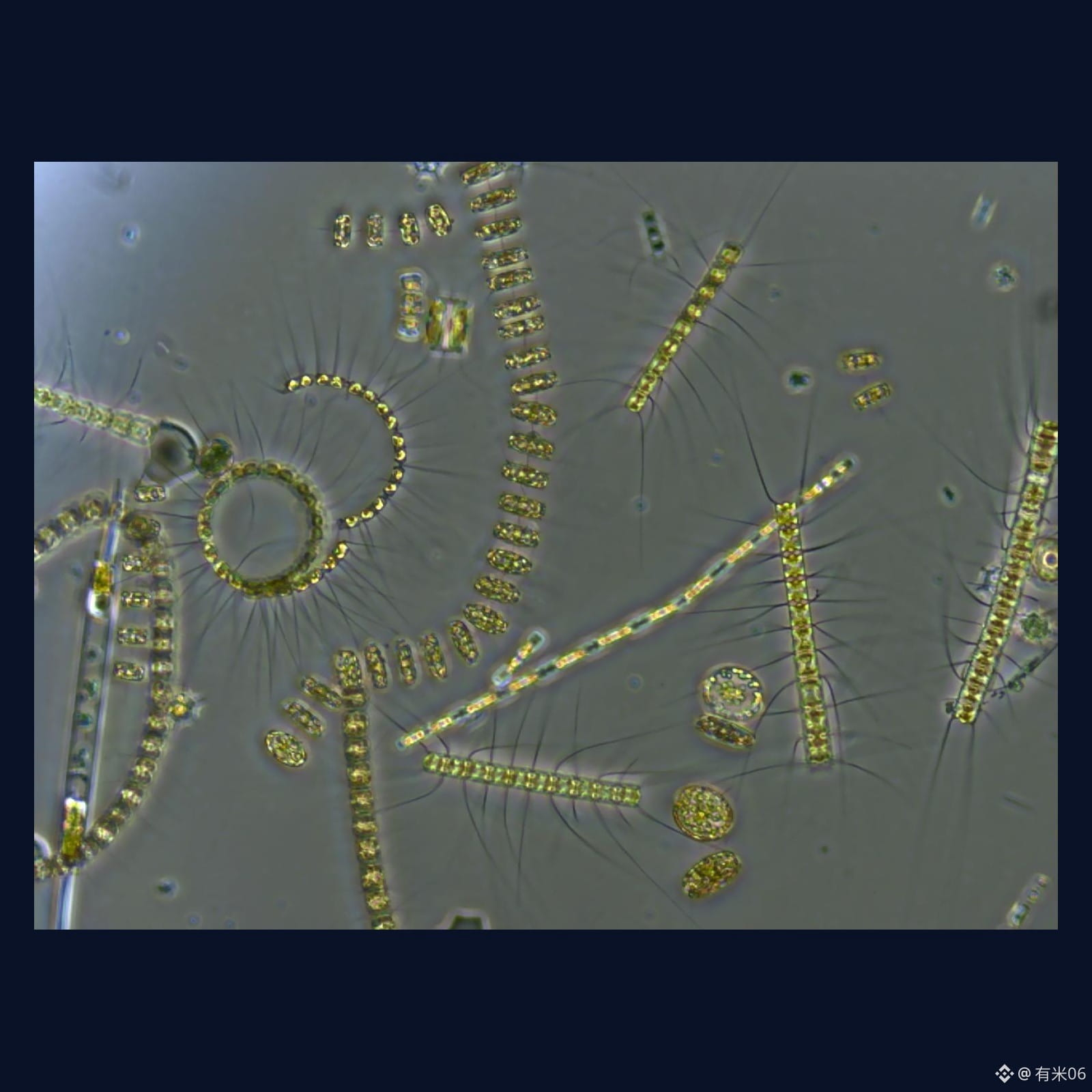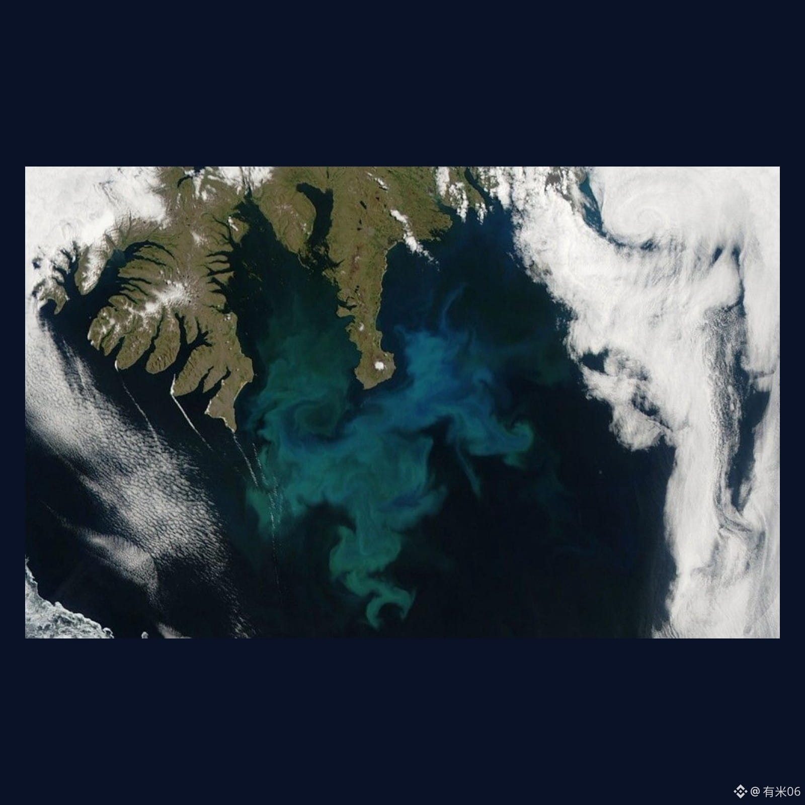
The base layer of the ocean food web—phytoplankton—“is often not fully visible” by satellite.
In a paper in *Geophysical Research Letters*, researchers from the University of Colorado Boulder (CU Boulder) and the U.S. National Center for Atmospheric Research (NCAR) explain their approach: they built a “satellite simulator” into Earth system models to deliberately recreate the blind spots that real satellites encounter—clouds, sea ice, low solar elevation angles, and gaps along the orbital scan. They then compared the simulated chlorophyll values against the “ground truth.” The results are striking. On the global scale, satellites capture only about 10% of the low extremes and about 19% of the high extremes on a daily basis. When clouds block the view or the solar angle gets too low, there isn’t enough reflected light, and surface chlorophyll can’t be read. Also, satellites only sample the top layer, so the total amount throughout the entire water column doesn’t match as well.
Publicity angle: Extreme events are crucial for ecosystems (large algal blooms can ripple through the upper food chain), but they’re rarely discussed—precisely because they’re barely visible in satellite data. This is a study of observational limits, not an attempt to discredit satellites. It’s a reminder: to understand phytoplankton variability, you need to overlay in-situ sampling with models.
Independent verification: *Geophysical Research Letters* DOI 10.1029/2025gl121347 (Clow / Lovenduski / Kay et al.; Crossref); CU Boulder Arts & Sciences Magazine press release, 2026-09-18.
Figure: Mixed phytoplankton microscopy (Stephanie Anderson / URI / NASA) + satellite bloom scene near Iceland (NASA); letterbox non-AI.
#科研 #海洋
In a paper in *Geophysical Research Letters*, researchers from the University of Colorado Boulder (CU Boulder) and the U.S. National Center for Atmospheric Research (NCAR) explain their approach: they built a “satellite simulator” into Earth system models to deliberately recreate the blind spots that real satellites encounter—clouds, sea ice, low solar elevation angles, and gaps along the orbital scan. They then compared the simulated chlorophyll values against the “ground truth.” The results are striking. On the global scale, satellites capture only about 10% of the low extremes and about 19% of the high extremes on a daily basis. When clouds block the view or the solar angle gets too low, there isn’t enough reflected light, and surface chlorophyll can’t be read. Also, satellites only sample the top layer, so the total amount throughout the entire water column doesn’t match as well.
Publicity angle: Extreme events are crucial for ecosystems (large algal blooms can ripple through the upper food chain), but they’re rarely discussed—precisely because they’re barely visible in satellite data. This is a study of observational limits, not an attempt to discredit satellites. It’s a reminder: to understand phytoplankton variability, you need to overlay in-situ sampling with models.
Independent verification: *Geophysical Research Letters* DOI 10.1029/2025gl121347 (Clow / Lovenduski / Kay et al.; Crossref); CU Boulder Arts & Sciences Magazine press release, 2026-09-18.
Figure: Mixed phytoplankton microscopy (Stephanie Anderson / URI / NASA) + satellite bloom scene near Iceland (NASA); letterbox non-AI.
#科研 #海洋