🟥 UKRAINE WAR: A REGIONAL MAP OF TERRITORIAL CONTROL 🇺🇦🇷🇺
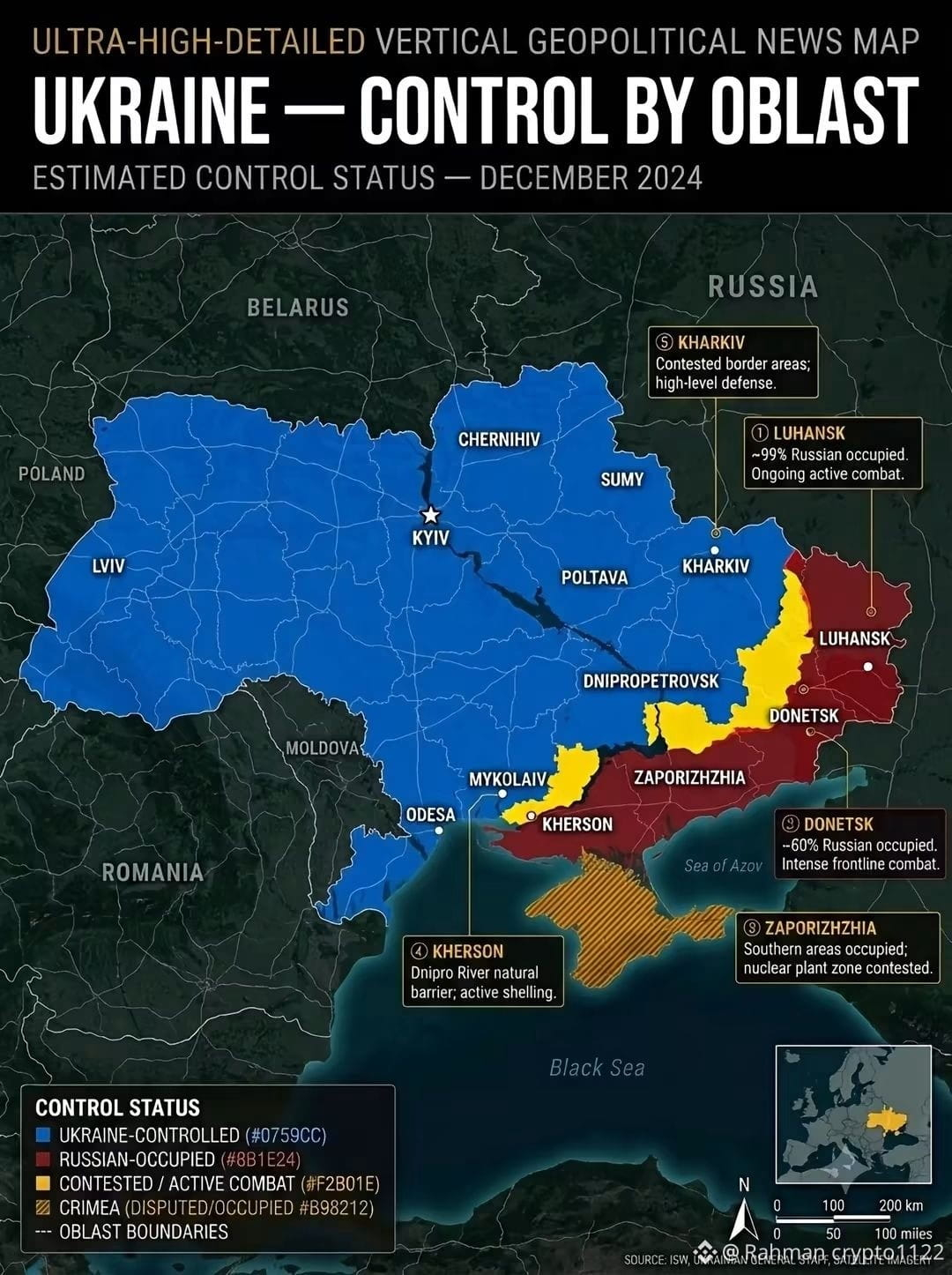
Ukraine’s oblast-level map highlights the complex geographical reality of the ongoing Russia–Ukraine war, showing Russian-occupied territories, contested areas and regions remaining under Ukrainian control.
Eastern and southern Ukraine, particularly Donetsk, Luhansk, Zaporizhzhia and Kherson, remain central to the territorial struggle.
📍 Why It Matters: The map provides a broader understanding of battlefield geography, territorial changes and the strategic importance of Ukraine’s administrative regions.
⚠️ Territorial control remains fluid, and frontline assessments may change as new evidence emerges.
References: Institute for the Study of War (ISW) – Daily Control of Terrain Maps; DeepStateMap; Russia Matters.
#Ukraine #RussiaUkraineWar #OblastMap #TerritorialControl #Donbas
$TFUEL $WIN $RARE
Ukraine’s oblast-level map highlights the complex geographical reality of the ongoing Russia–Ukraine war, showing Russian-occupied territories, contested areas and regions remaining under Ukrainian control.
Eastern and southern Ukraine, particularly Donetsk, Luhansk, Zaporizhzhia and Kherson, remain central to the territorial struggle.
📍 Why It Matters: The map provides a broader understanding of battlefield geography, territorial changes and the strategic importance of Ukraine’s administrative regions.
⚠️ Territorial control remains fluid, and frontline assessments may change as new evidence emerges.
References: Institute for the Study of War (ISW) – Daily Control of Terrain Maps; DeepStateMap; Russia Matters.
#Ukraine #RussiaUkraineWar #OblastMap #TerritorialControl #Donbas
$TFUEL $WIN $RARE